A tower map gets you a starting bearing and nothing more. The reliable way to find the nearest cell tower in a rural area is to read the tower your phone is actually connected to, using your phone’s field test screen, then convert that into a compass bearing and confirm it by measuring dBm as you sweep the antenna. Map pins come from FCC registration records and crowd reports, and both are incomplete in exactly the places rural readers live. Your own signal reading is the only source that describes your address rather than a model of it.
This article assumes you already have a shortlist of candidate towers. If you do not, start with the general method in our guide to finding the nearest cell tower to your home, then come back here. From this point on the question is not where the towers are. It is which one deserves your antenna, and how you point at it.
Why the Map Pin Is Not the Tower You Are Connected To
Almost every page that ranks for this search is either selling boosters or selling its own tower map, and the maps come from two places. One is the FCC’s Antenna Structure Registration system. The other is crowd-sourced reporting, where users’ phones upload the towers they see.
Both have the same blind spot, and it matters more the further out you live. The FCC’s registration system exists for aviation safety, not consumer research. A structure has to be registered when it is taller than 200 feet above ground level, or when it may interfere with the flight path of a nearby airport. Plenty of rural cell equipment sits on shorter monopoles, grain elevators, water towers, silos and building roofs that never meet either trigger. It is carrying your call, and it is not in the registry. You can search the registry yourself through the FCC’s Antenna Structure Registration resources, but read it as a partial list of tall steel, not a map of the network.
Crowd-sourced maps have the opposite problem. They are only as good as the number of people who have driven past with the app running. In a county with few people, that number is small and the data is old. A tower can be re-equipped or reassigned to a different carrier without any map catching up.
There is a second, quieter issue that no tower map fixes. The pin marks a structure. Your signal comes from a sector, and the sector is a panel pointing one direction off that structure. Sector antennas are commonly built in 120, 90 or 60 degree beam widths, and the three-by-120 layout is the usual starting point for a macro site. The pin tells you where the pole is. It does not tell you whether any panel on that pole is facing you.
Your Phone Already Knows Which Tower It Is Using
This is the part the ranking pages skip. Your phone is not guessing about the tower. It is connected to a specific cell and it reports that cell’s identity, and you can read it.
On an iPhone, open the Phone app keypad, dial *3001#12345#* and tap call. Field Test Mode opens instead of placing a call. Look for the serving cell section, which is usually labeled with the radio technology (RAT). Inside it you will find a cell identity value (often shown as Cell_id or ci), a Tracking Area Code, the carrier’s network codes, and the band you are on. On Android the path depends on the manufacturer, and some phones expose the cell identity in Settings under About Phone and SIM Status while others require a third-party network info app. The step-by-step for both platforms, including where the signal number lives, is in our guide to checking your dBm signal strength.
Write down two things: the cell identity, and the RSRP reading, at a fixed outdoor spot. That pair is worth more than any map, because it names the exact sector that is currently serving your house.
One honest caveat. Not every phone, iOS version, carrier or SIM configuration exposes the full serving cell detail. If yours does not, skip ahead to the perimeter walk further down. That method needs nothing but a signal reading.
Turning a Cell Identity Into a Direction
On LTE, the cell identity your phone reports is a 28-bit number that the standard splits into two parts. The top 20 bits identify the base station (the eNodeB). The bottom 8 bits identify the sector on it. In practice that means:
- Divide the cell identity by 256 and drop the remainder. That is the base station ID.
- The remainder itself is the sector number on that base station.
So a cell identity of 12345678 gives a base station ID of 48225 and sector 78. Two readings that share the same base station ID are the same physical site seen from two different panels. Two readings with different base station IDs are genuinely different towers, however close together the pins look.
That base station ID is the number to search on a mapping tool that indexes by operator cell IDs rather than by address. When the tool finds it, you get a plotted location for the site your phone is actually using, not the nearest structure on a list. Some tools will also draw the sector’s azimuth, which is the compass direction the panel faces. If you get that, you have the two ends of the line you need to aim along.
Two limits to keep in mind. First, this decoding is a convention of LTE macro network layouts, not a law of physics, and some operators number sectors in their own way. Second, 5G NR uses a different, longer cell identity whose split between base station and cell is not fixed the same way, so the divide-by-256 shortcut does not carry over. If your phone is camped on 5G, switching the test phone to LTE for the diagnosis often gives you a cleaner identity to work with.
The Step That Quietly Ruins Good Aiming: True North vs Magnetic North
You now have a bearing from a map. A map bearing is measured from true north. Your phone’s compass, and most handheld compasses, measure from magnetic north. Those are not the same direction, and the gap between them (called declination) changes depending on where you stand and drifts slowly over the years.
For a Wi-Fi router this would not matter. For a directional antenna pointed at a tower several miles away, aiming a few degrees off the intended line moves the far end of that line a long way. Look up the declination for your own coordinates with the magnetic declination calculator published by NOAA’s National Centers for Environmental Information, then apply it to your map bearing before you touch the mast.
Then check the compass itself. A phone compass sitting next to a steel mast, a mounting bracket, a truck or a magnetic tool tray is reading the metal, not the earth. Take the bearing standing several steps clear of the mount, sight along it to a landmark on the horizon, and aim at the landmark instead of at the compass needle.
What Each Clue Actually Tells You About Direction
| Clue | What it tells you about direction | How much to trust it alone |
|---|---|---|
| Map pin for a registered structure | Where a tall structure stands, if it was tall enough to require registration | Low. It may not be your carrier’s site, and it says nothing about which panel faces you |
| Crowd-sourced coverage point | Where somebody’s phone once saw a tower | Low to moderate. Thin and dated in low-population areas |
| Serving cell identity from field test | The exact base station and sector serving you right now | High, once decoded and located. This is the strongest single clue |
| Outdoor dBm readings around the property | The rough side of the property the signal arrives from | Moderate. Coarse, but it is a measurement rather than a model |
| Sweep test with the antenna mounted | The specific bearing that produces the best reading at your mast | Highest. It is the only test that includes your terrain, your mast and your hardware |
The Perimeter Walk, When the Data Runs Out
If your phone will not give up a cell identity, you can still find a direction. Walk the outside of the property and take a dBm reading at each of the four sides, then at the corners, standing well clear of walls and vehicles, and give each reading time to settle before you write it down. Phones average their signal measurements, so the number moves for a few seconds after you stop walking.
The side with the consistently strongest readings is the side the signal is arriving from. That is a coarse answer, roughly a quadrant rather than a bearing, but it is enough to narrow which candidate tower is plausible and to rule out the ones behind the hill. Terrain deserves a real look before you commit to a mast position, because a nearer tower behind a ridge routinely loses to a further one with a clear view, a tradeoff we cover in distance versus obstructions in cell signal.
Aiming Is an Iterative Process, Not a Setting
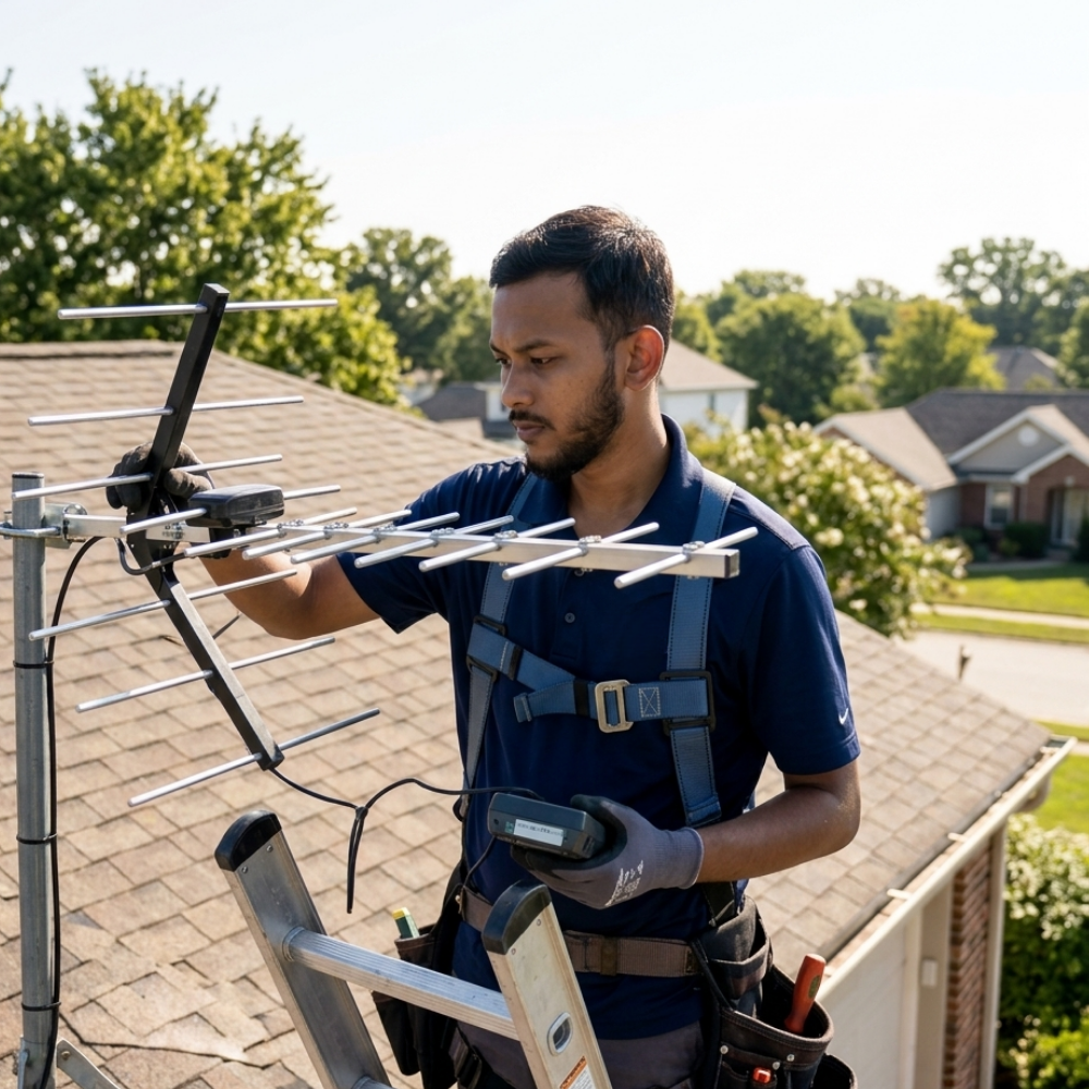
Here is where most rural installs go wrong. People calculate a bearing, bolt the antenna at that bearing, and stop. A directional antenna wants to be tuned, not set.
A workable sequence, with the antenna mounted but the clamp left loose enough to rotate:
- Point it at your calculated bearing and let the phone settle at the antenna’s own position, or at the far end of the cable if you can watch a reading there.
- Rotate a small increment, perhaps five to ten degrees, and wait for the reading to stop moving before recording it.
- Sweep the whole plausible arc that way, writing every reading down against its bearing. Do not stop at the first improvement.
- Go back to the best bearing, then repeat with smaller increments around it.
- Only when the horizontal bearing is settled, adjust the vertical angle, then tighten.
Two things make this easier. A second person to call out readings while you turn the mast saves an hour of climbing. And a note of the cell identity at each promising bearing tells you when you have swung onto a different tower entirely rather than a better angle on the same one, which is useful information a bare signal number hides.
Be aware that sector panels are commonly tilted slightly downward so their strongest energy lands nearer the site, which is one reason the theoretical straight line to the tower is not always the practical best bearing. Judge by the measured reading, and judge it against what the number actually means, which our guide to what counts as a good dBm signal strength sets out.
Why the Nearest Cell Tower in a Rural Area Is Often Not the Best One
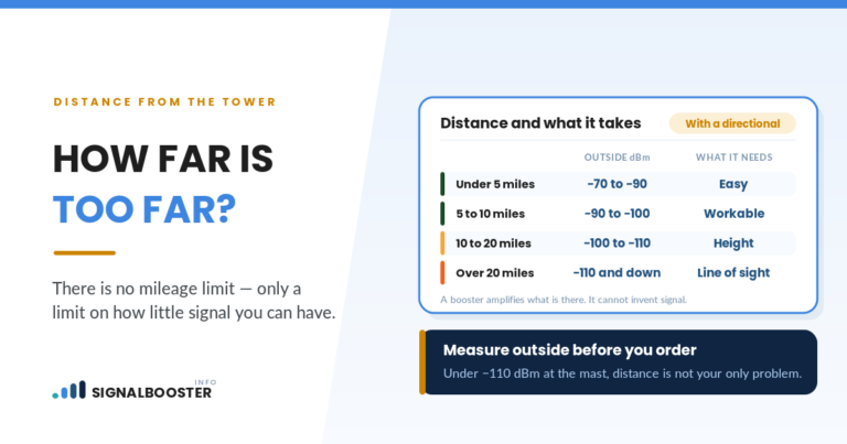
Distance is the first thing people optimize and rarely the thing that decides the result. Four other variables regularly beat it.
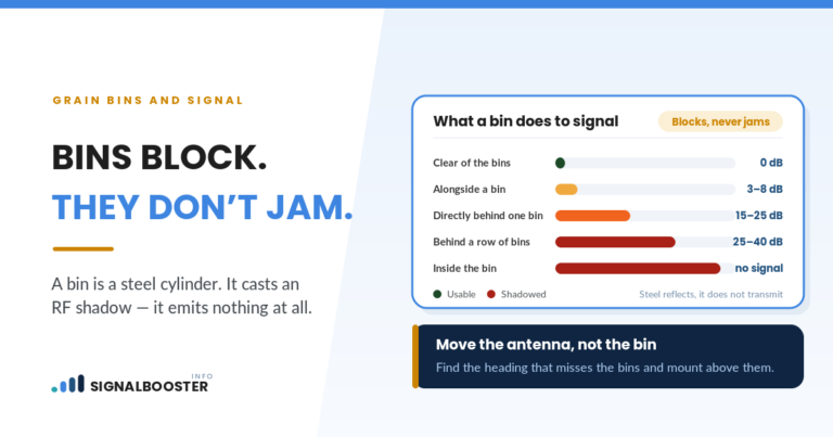
Line of sight. A ridge, a shelterbelt or a stand of mature trees between you and a nearer tower can cost more than the extra miles to a tower you can see.
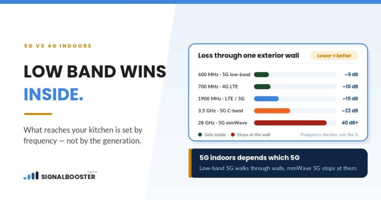
Band. Lower-frequency bands travel further and pass through obstacles better than higher ones. A distant tower serving you on a low band can beat a closer one on a high band, which is part of why signal sometimes gets worse after a network change rather than better.
Sector orientation. A tower a mile away with every panel pointed at the highway is worse for you than one three miles away with a panel pointed at your valley.
Load. Rural macro sites can cover a large area with few alternatives, so a tower with good coverage of your address can still be congested at predictable times of day. That is a capacity problem, and no amount of aiming fixes it.
The Honest Part: Aiming Decides Whether a Booster Helps, and Sometimes Nothing Does
A cellular booster amplifies the signal that reaches your outside antenna and rebroadcasts it indoors. It does not create signal. That is the entire physics of the product, and it is the sentence most pages selling one leave out. Our explainer on what a signal booster actually is covers how that amplification works.
Two consequences follow, and both are worth knowing before you spend anything.
The first is that aiming is not a finishing touch, it is the variable that decides the outcome. The same hardware, on the same mast, at the same property, produces a different result at a good bearing than at a mediocre one, because what the system has to work with is whatever the outside antenna captured.
The second is the harder one. If you have swept the full arc, tried every candidate tower, and the best outdoor reading you can find is still at the floor of what your phone can register, then there is not enough signal at your property for an amplifier to work with. That is not a reason to buy a higher-gain antenna and hope. It is a reason to look at Wi-Fi calling, at a carrier that actually has a site facing your valley, or at satellite service. It is a small minority of rural properties, but it exists, and finding out before the purchase is much cheaper than finding out after.
FAQ
Can I find the nearest cell tower in a rural area without an app?
Yes. Take dBm readings at each side and corner of your property, letting each one settle before you record it. The side with the strongest consistent readings is the direction your signal arrives from. It is coarse compared with reading your phone’s serving cell identity, but it needs nothing extra and it is a real measurement rather than a prediction.
Does the FCC tower database show every cell tower near me?
No. The FCC’s Antenna Structure Registration system requires registration for structures taller than 200 feet above ground level, or those that may interfere with a nearby airport’s flight path. Shorter monopoles, rooftop mounts and equipment on existing structures such as water towers and silos often fall outside it, and the registry does not say which carrier’s equipment is on a given structure.
Should I aim my antenna at the closest tower?
Not automatically. Line of sight, the frequency band, which way the tower’s sector panels point, and how loaded that site is can all matter more than distance. Aim at the tower that produces the best measured reading at your mast, which is not always the nearest pin on a map.
How far off can a compass bearing be if I ignore magnetic declination?
It depends entirely on where you are, since declination varies by location and shifts over time. That is why it needs to be looked up rather than estimated. Check your own coordinates against NOAA’s magnetic declination calculator and correct the map bearing before aiming, because over several miles a small angular error becomes a large miss.
What if no aiming position gives me a usable signal?
Then the outside signal at your property is too weak for an amplifier to work with, because a booster strengthens an existing signal rather than creating one. At that point the realistic options are Wi-Fi calling over a wired internet connection, a different carrier with a better-placed site, or satellite service, rather than more antenna gain.